I just figured out how to get metabase to split a cell and reliably pull GPS data into two custom columns (labeled Longitude and Latitude). When I go to visualize, I select map and here's where I hit the issue. When I go to tell metabase what column is longitude or latitude, it won't give me those columns as options. I verified that the custom columns I made are numerical (they have the "#" sign indicating so when viewing through the filter section).
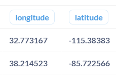
The long/lat are in a 9 digit format (i.e. 37.161084 and -86.523160 and each in their separate column). What could be the issue and how can I work past it? I've tried looking through the forum here and I wasn't able to deduce anything. Any help is always appreciated!
What version of Metabase are you running @paintbb84? can you send us the troubleshooting info?
Ummmm, I'm not sure. I'll have to take a look and try and find that out. What troubleshooting info are you looking for?
Thanks @paintbb84, but also send us the all the troubleshooting info and the functions you're using to separate the lat/lon from a field, we need to reproduce what you're seeing in order to help you
@dragonsahead
Here's what my columns look like:
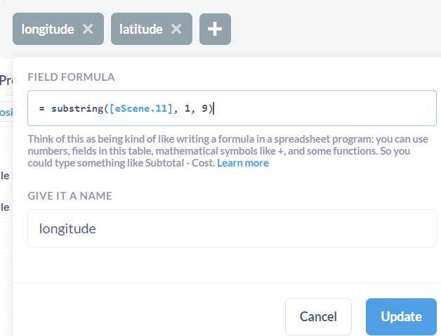
The custom columns come from this column:

The formulas I used:
My admin says they can't go and format the column for me since its a custom column. They can only affect the source data.
I solved my problem by going through SQL and using a convert function. But now since I used SQL, I have to go back and figure out how to use variables so I can filter by date. I haven't done that before so I'm a tad overwhelmed about where to put this in.