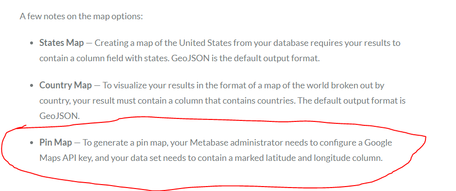
If your table has a latitude and longitude column and you select the Map visualization, it should work automatically. You can try it with the People table in the Sample Dataset to see how it should work.
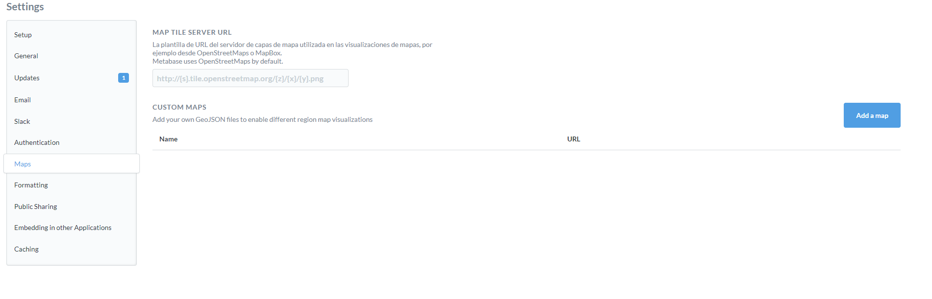
The bit on that doc page about configuring a google maps api key I believe is wrong/out of date. I’ll fix that.
EDIT: Actually, the documentation you’ve shown in your screenshot I believe is from an old version. Please double check you’re referring to the latest version of the docs: https://metabase.com/docs/latest/
@rviteri
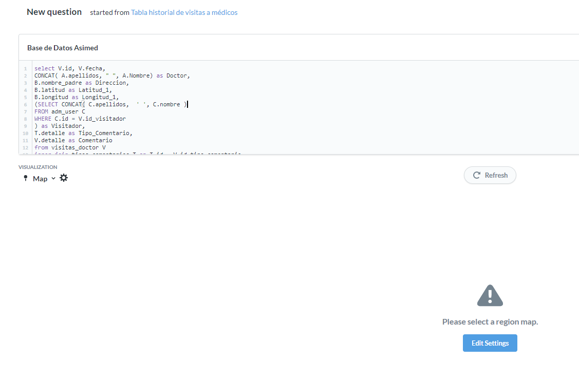
Are you getting your dataset from a Custom Query or Native Query (SQL)?
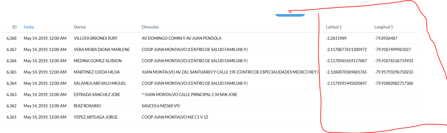
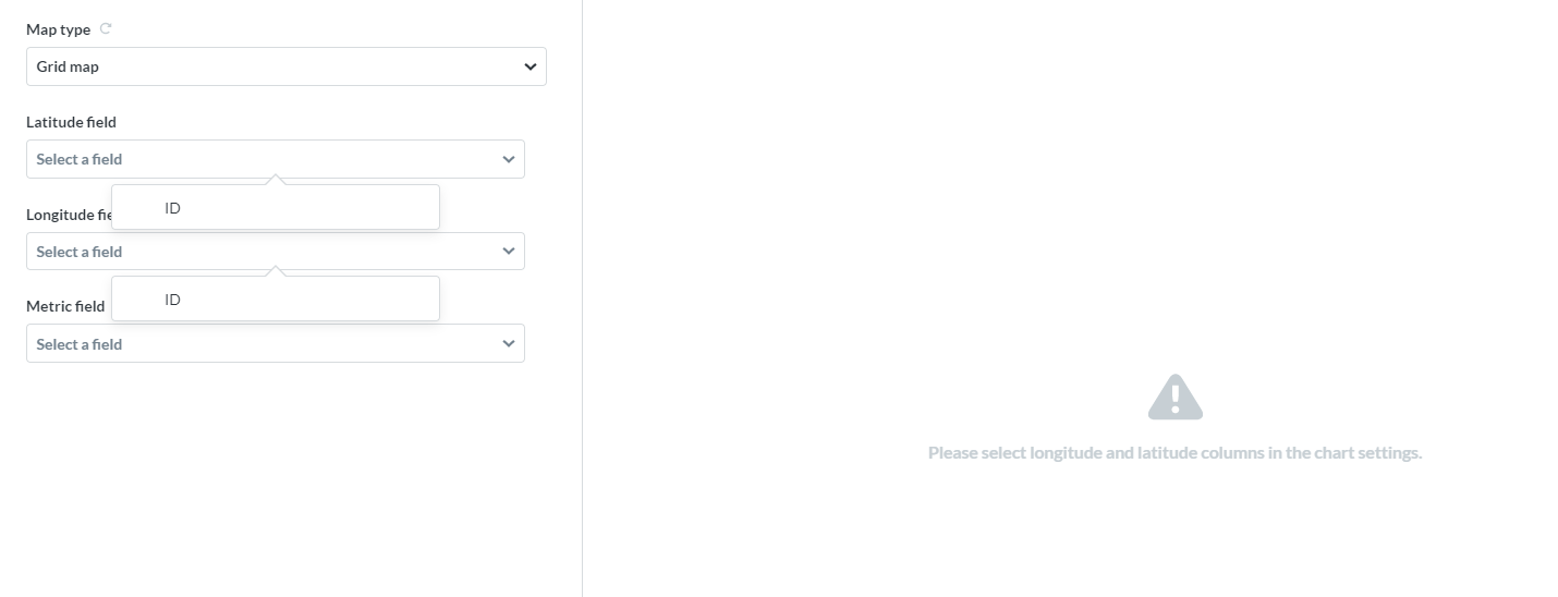
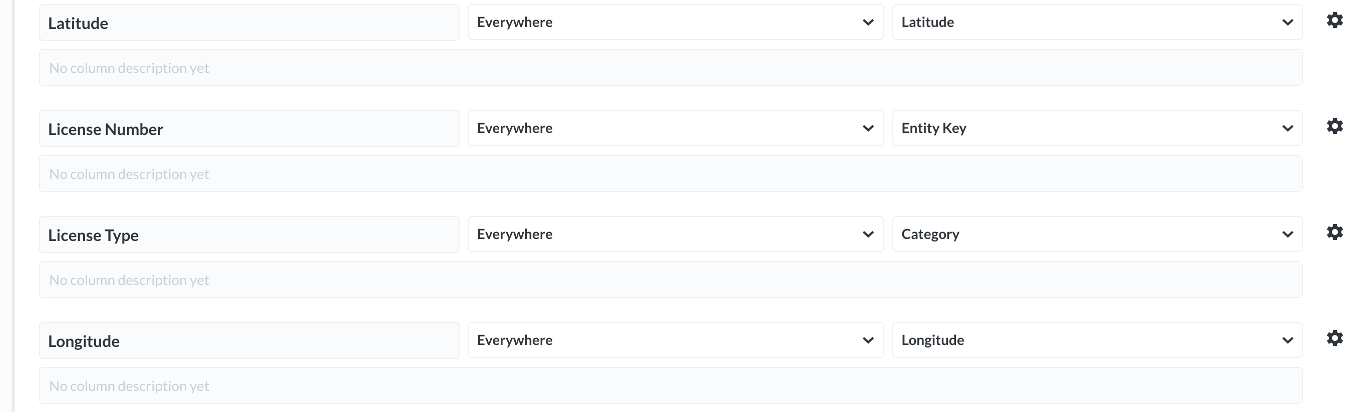
What is the “Field Type” of Latitud 1 and Longitud 1?
Admin Settings > Data Model > (database) > (table) > (column)
There’s a handful of various fixes to maps in 0.32.x
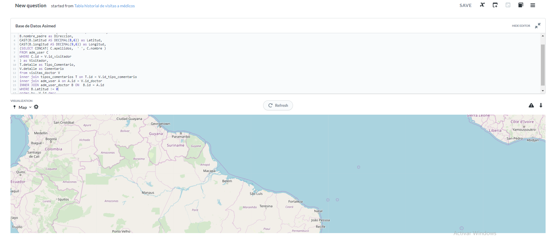
Native Query:
select V.id, V.fecha,

CONCAT( A.apellidos, " ", A.Nombre) as Doctor,

B.nombre_padre as Direccion,

B.latitud as Latitud_1,

B.longitud as Longitud_1,

(SELECT CONCAT( C.apellidos,  ' ', C.nombre )

FROM adm_user C

WHERE C.id = V.id_visitador

) as Visitador,

T.detalle as Tipo_Comentario,

V.detalle as Comentario

from visitas_doctor V

inner join tipos_comentarios T on T.id = V.id_tipo_comentario

inner join adm_user A on A.id = V.id_doctor

INNER JOIN adm_user_doctor B ON  B.id = A.id

order by  V.id desc
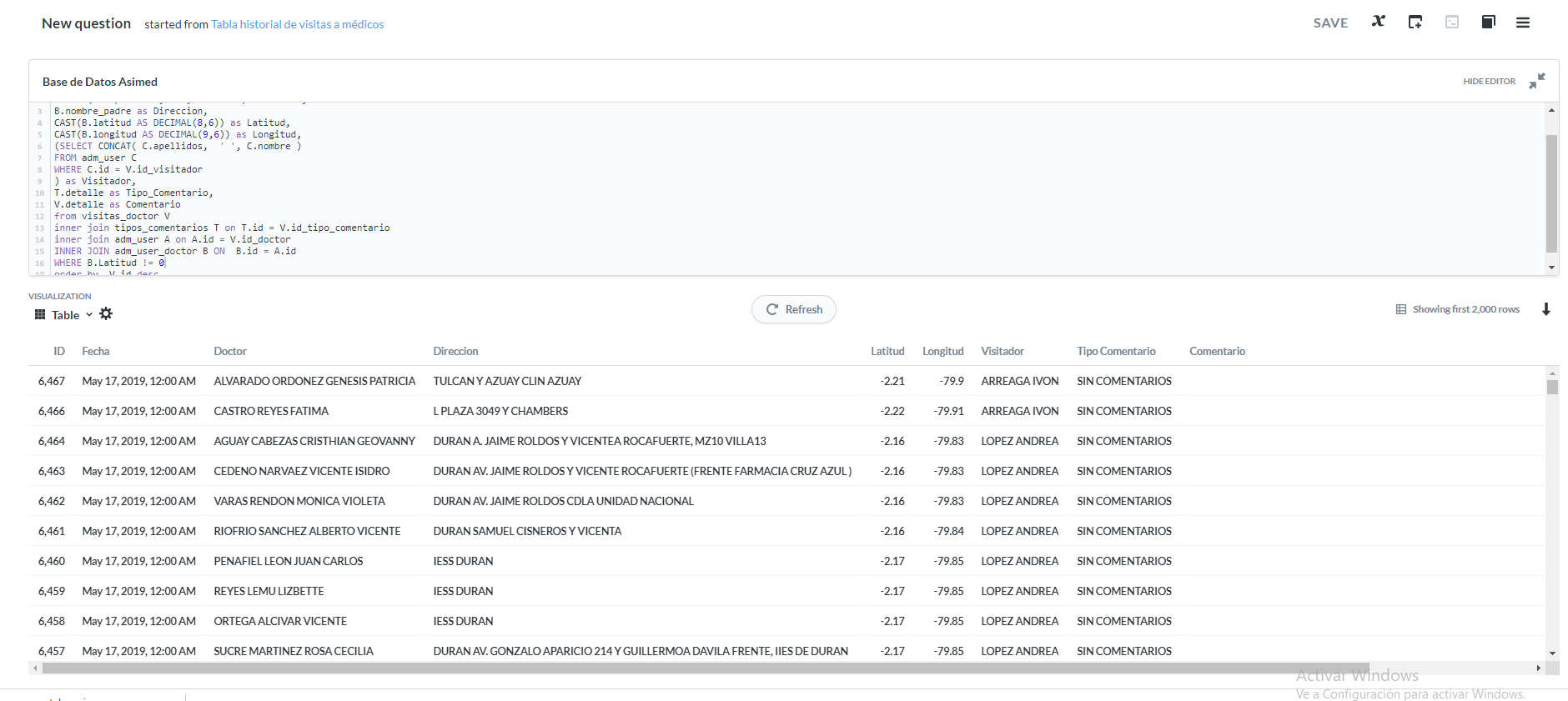
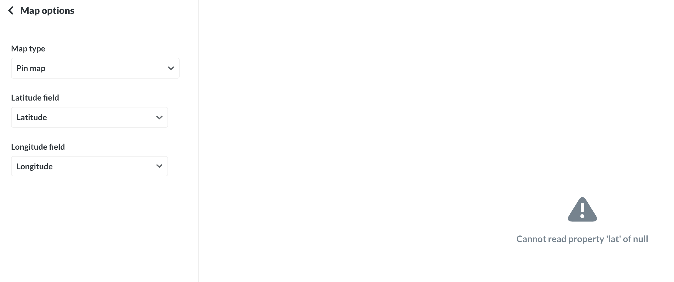
The fields are set to latitude and longitude respectively:
Just discovered an easy workaround : creating a new custom question with the editor from sql query (very simple custom question just like a select * query). It works fine.
Don’t believe to put a filter if you have more than 1K lines in your result data set.


 on the first post: